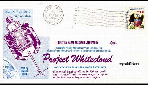
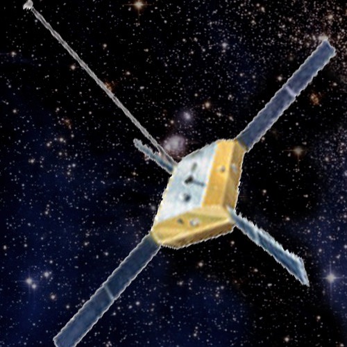
Beskrivning : It placed a cluster of one primary satellite and three smaller sub-satellites (that trailed along at distances of several hundred kilometers) into low polar orbit. This satellite array determined the location of radio and radars transmitters, using triangulation, and the identity of naval units, by analysis of the operating frequencies and transmission patterns.
As a result of ground processing of direction-finding data on the signals from target emitters provided by a group of satellites, and also sequentially by several groups of satellites, the coordinates, direction and speed of travel were obtained.
Vandenberg post stamp and Whitecloud satellite.