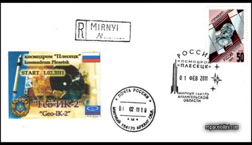
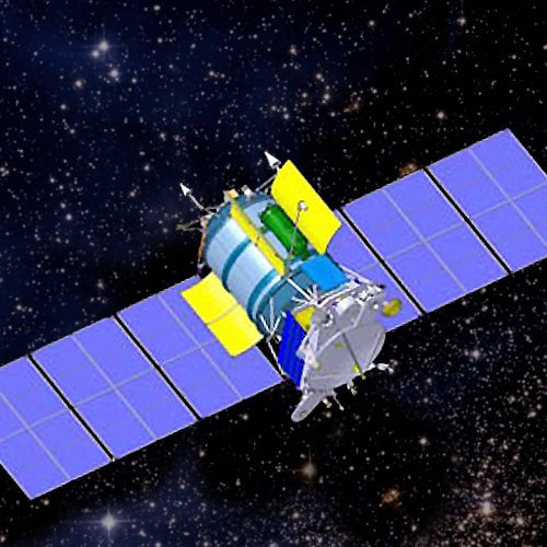
Beskrivning : The satellite was launched by a Rokot/Breeze KM rocket, however, the launch was unsuccessful as the satellite was placed into a lower than planned orbit. It was intended to operate in a circular orbit at an altitude of approximately 1,000 km, but only reached a low-earth orbit. Geo-IK 2 payload was the first of two new satellites planned for geodetic measurements of Earth`s shape, rotation, and gravitational field. Geo-IK 2 was also designed to probe plate tectonics, tides, and movements of the poles.